SEA LEVELS - MALDIVES
Elsewhere (http://www.climatedata.info/impacts/sea-levels/pacific-islands/) we have presented data on sea levels for a group of Pacific Islands and also on global sea levels (http://www.climatedata.info/impacts/sea-levels/). The data on these graphs come from two sources: the Australian Bureau of Meteorology and University of Colorado Sea Level Research Group. In the first case the data were from tide gauges: in the second from satellites.
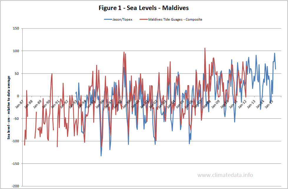
In addition to global sea levels the satellite data contain sea levels for specific regions of the earth one of which is the Maldives. There are also tide gauge data for these islands which make direct comparison possible. The tide gauges were Gan II and Male and their data were downloaded from the Permanent Service for Mean Sea Level (PSMSL). The data from the two tide gauges were merged and adjusted to give the same average as the satellite derived values.
The two data sets are plotted on figure 1. They show a high level of agreement in both the timing and magnitude of sea level changes. The satellite data are derived from a series of satellites (Topex, Jason-2 and Jason-2) whose data are spliced to form a continuous series. The similarity of the two records suggests that there are no systematic errors resulting from the splicing.
The tide record suggests that sea levels for the Maldives are increasing at 3.5 mm/year. The equivalent figure for the satellites data is 3.2 mm/year.
http://www.climatedata.info/