SEA LEVELS - PACIFIC ISLANDS
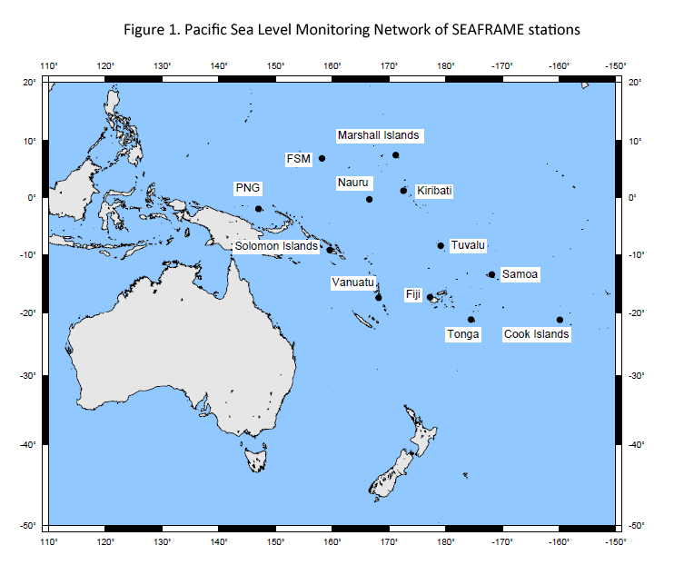
There is concern that sea level rise might threaten the existence of some small island communities. Since the start of the 1990s the Australian Bureau of Meteorology (BOM) has run the South Pacific Sea Level & Climate Monitoring Project. Every month the tidal centre publishes an update on their work. Figure 1 shows the 12 island groups.
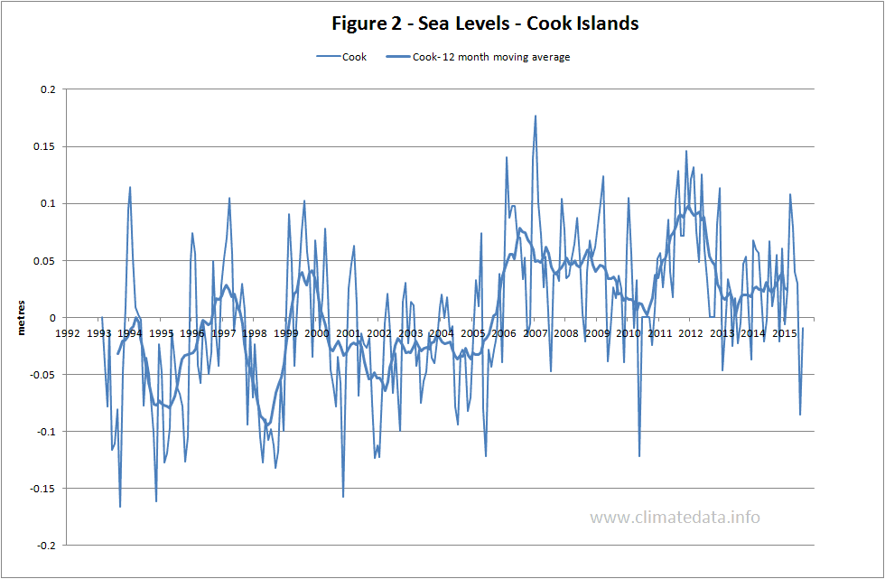
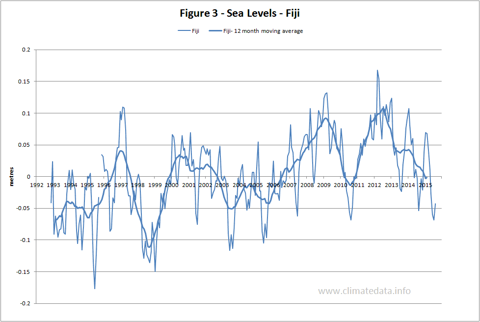
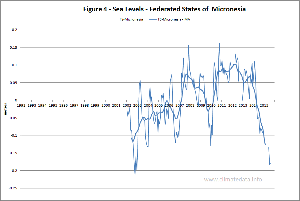
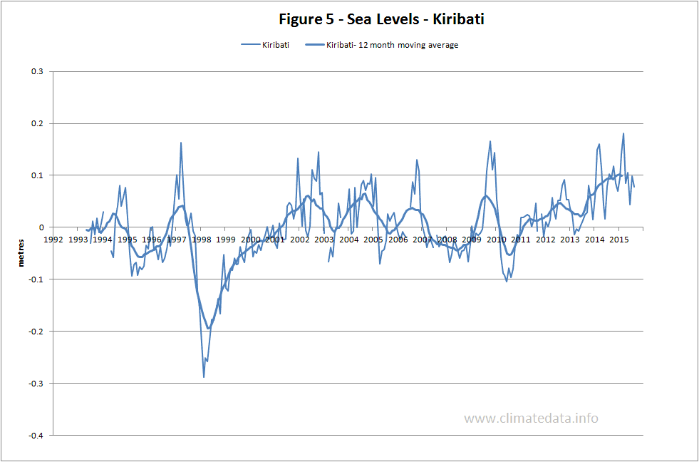
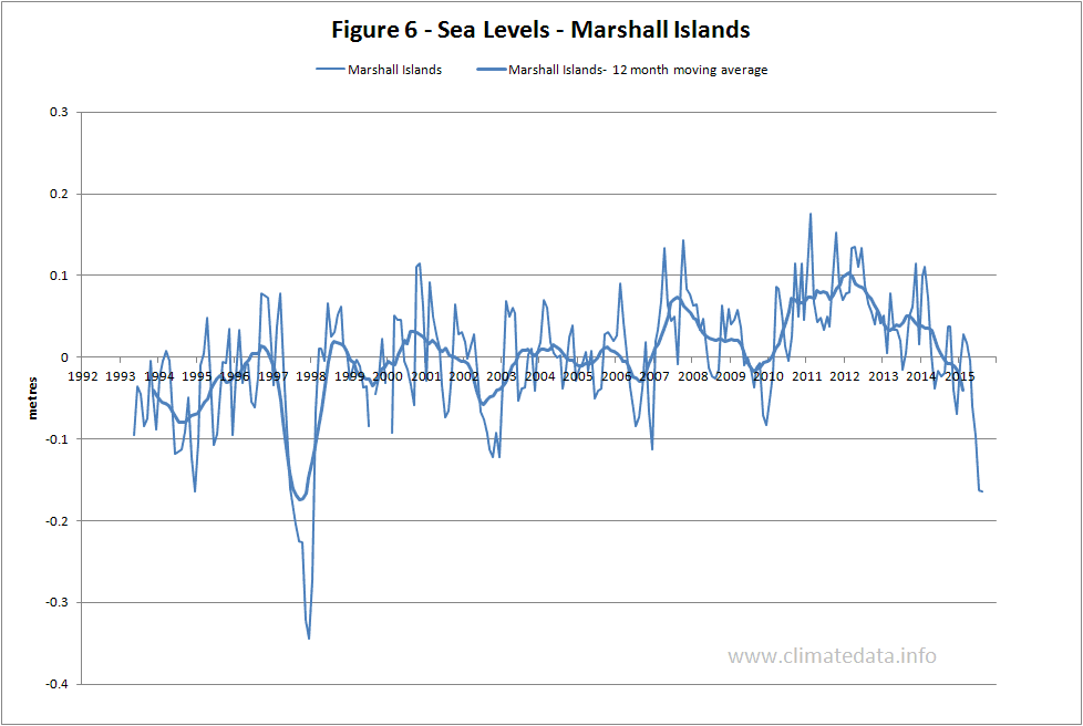
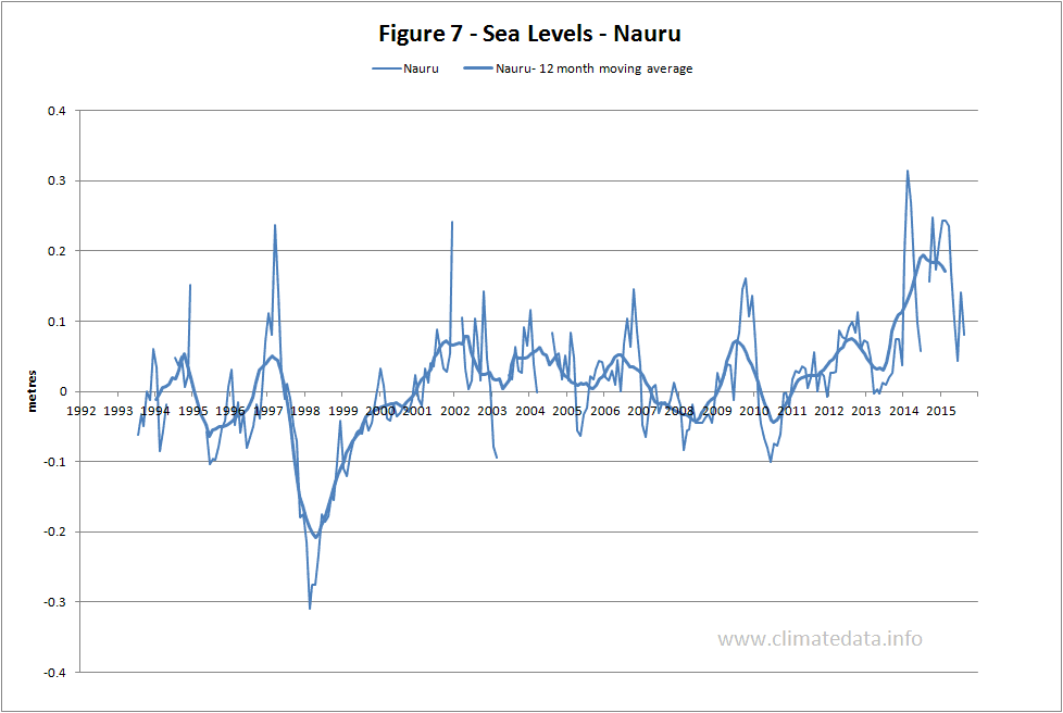
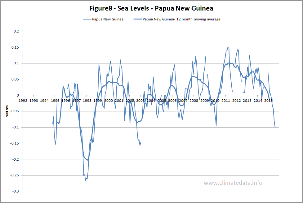
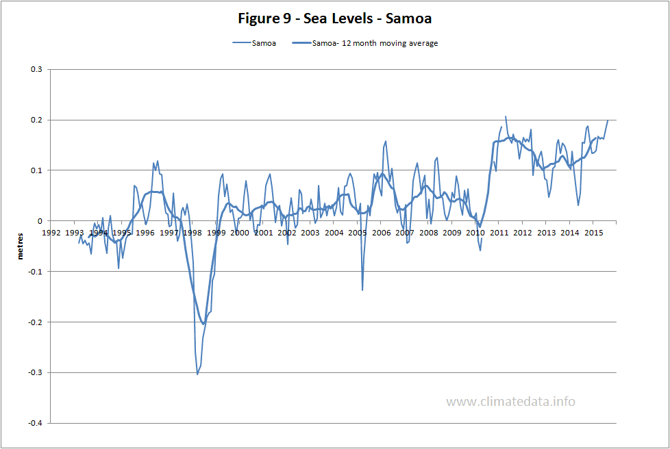
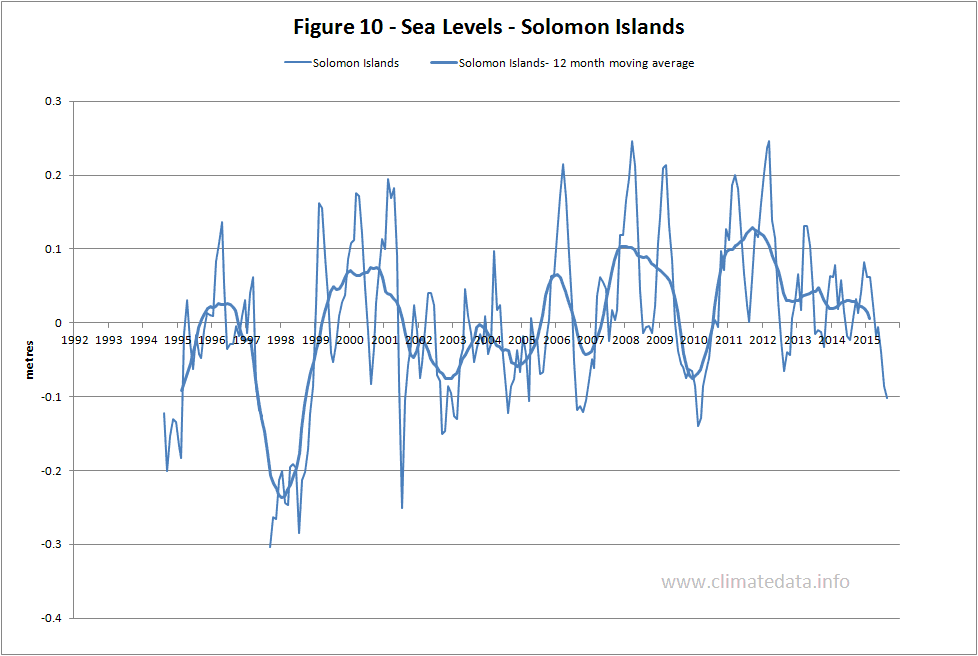
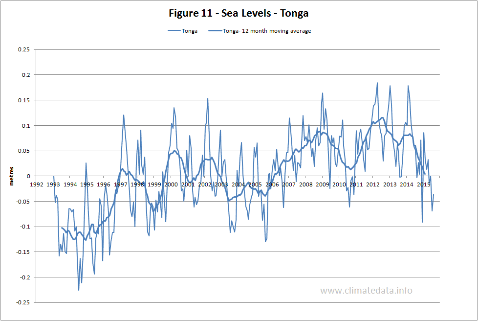
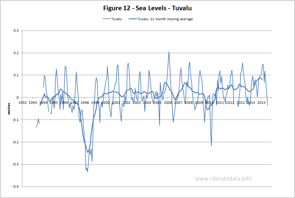
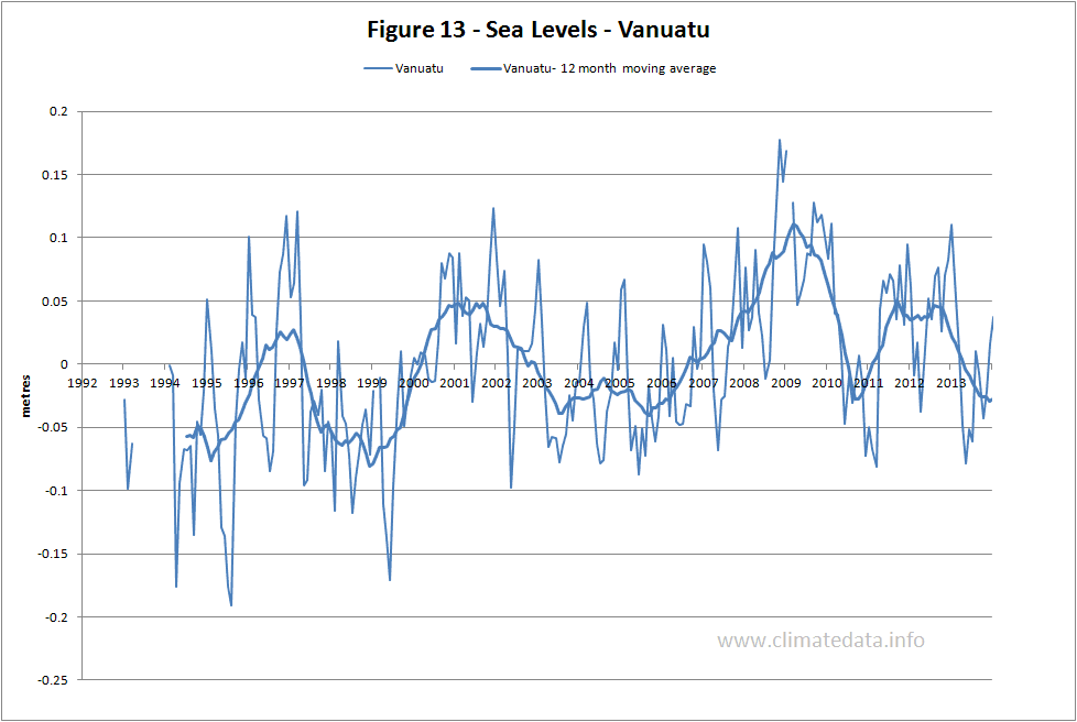
Figures 2 to 13 show monthly average sea level relative to a local datum for each of the sites. The data were downloaded from:
http://www.bom.gov.au/oceanography/projects/spslcmp/data/monthly.shtml.
What all of these graphs show is that there are significant variations in sea level. For many of the measuring sites the lowest levels occurred in 1998. This is a feature, seen most clearly in the moving average plots; it is related to the effect of the El Nino of 1997 which was followed by a world-wide temperature increase. The graphs also show that for the period of record sea levels are tending to increase.
The Bureau of Meteorology estimates the rate of rise to be in the range of 3.4 to 11.6 mm/year. They advise caution in interpreting these figures which are based (in terms appropriate for sea level change) on short records.
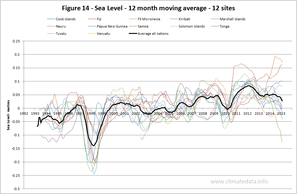
Figure 14 is a composite of all twelve island sites. A trend line through the line representing the average of all sites gives an average rate of increase in sea level of 5 mm/year.
http://www.bom.gov.au/oceanography/projects/spslcmp/data/monthly.shtml.
What all of these graphs show is that there are significant variations in sea level. For many of the measuring sites the lowest levels occurred in 1998. This is a feature, seen most clearly in the moving average plots; it is related to the effect of the El Nino of 1997 which was followed by a world-wide temperature increase. The graphs also show that for the period of record sea levels are tending to increase.
The Bureau of Meteorology estimates the rate of rise to be in the range of 3.4 to 11.6 mm/year. They advise caution in interpreting these figures which are based (in terms appropriate for sea level change) on short records.
Figure 14 is a composite of all twelve island sites. A trend line through the line representing the average of all sites gives an average rate of increase in sea level of 5 mm/year.
http://www.climatedata.info/